Humans are an unpredictable species. Occasionally we forsake the creature comforts of our modern society and community – the luxuries of warmth, electricity and social media – and simply don a backpack and a pair of boots and climb things, the taller the better.
I found myself in Reykjavik, Iceland at the end of August 2016. I had heard stories of spectacular out-of-this-world mountain ranges and hills that are unlike any other environment on Earth. I had to climb it.
A journey of 37 hours flying and transiting from Adelaide to Dubai, to London, to Dusseldorf and finally Reykjavik – my first impression was wow, the airport of Keflavik – 40km outside of the capital city of Reykjavik was quite funky and hip, and free wifi! Which led me to my first duty-free purchase in over 3 years – an assorted bag of 25 mini chocolate bars such as Mars, Snickers, Bounty etc. This ‘strategic’ purchase was not to satisfy my sweet tooth but simply for glucose and carbohydrates for the impending trek – energy for when we are on the move.
As with 99% of travellers and tourists arriving in Iceland – I caught the bus into the capital city, which I then transferred onto a van with a few sleep-deprived Europeans to be dropped off at our hotels and hostels individually. This is a fantastic service that runs through most of the night and reminiscent of the tourist-centric transportation network that covers Iceland.
PHOTOGRAPHY EQUIPMENT
As a working photographer, I decided on bringing the Sony A7RII for landscape photos, and the smaller Sony A6000 for general purpose photos. It turned out, by the end of the trek, the A7RII did not leave the comfort of the camera bag at all along with the tripod, and all the photos you will see below were taken with the Sony A6000. My reasons for not using the bigger camera was due to the constantly changing weather conditions we encountered, and the speed of which we were walking every day, which would have made setting up the camera and tripod tedious and time consuming. I carried an extra 3kg for nothing.
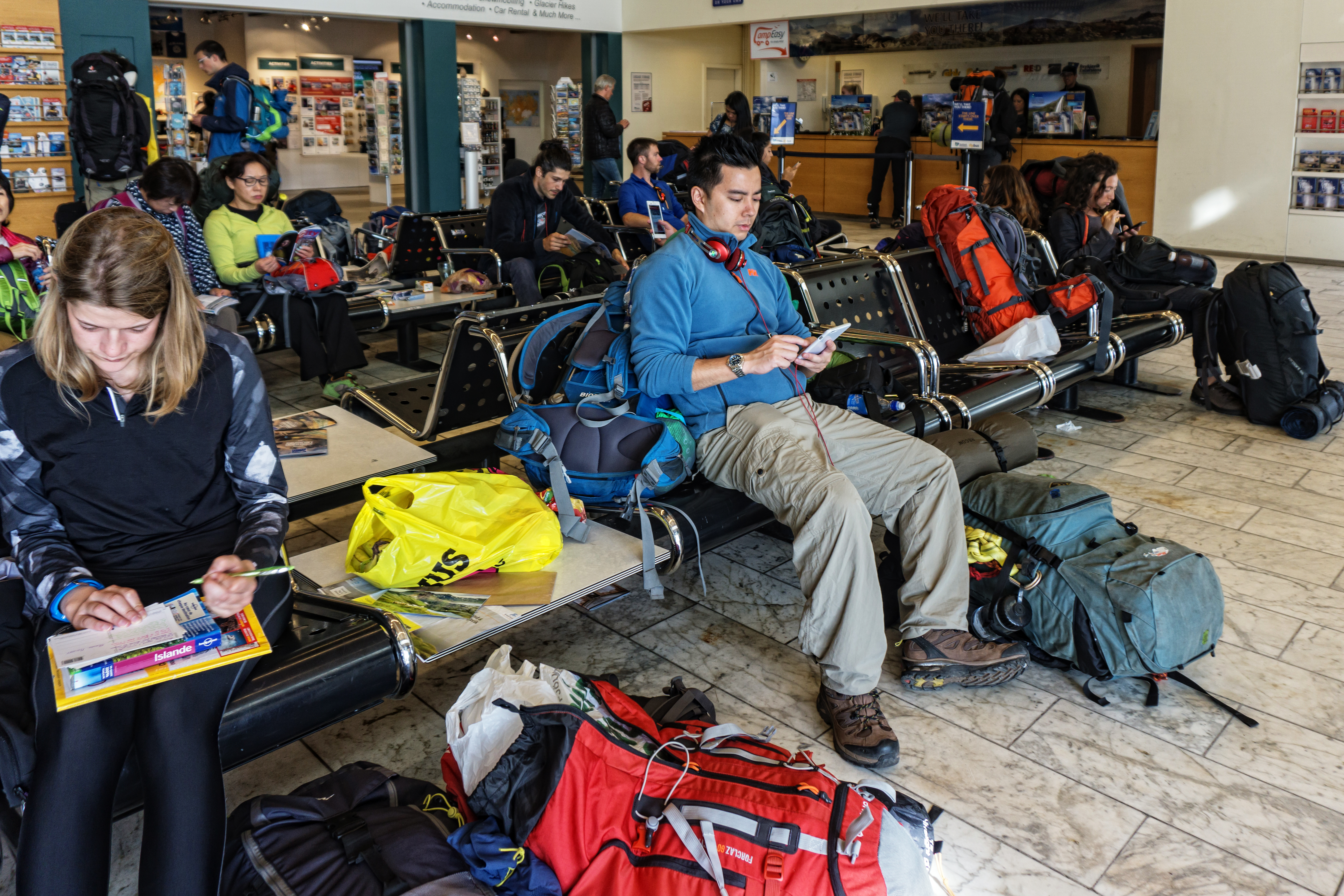
 *Waiting for the 4WD bus at the BSI Station to take us to Landmannalaugar campsite and jump-off point for the trek*
The next morning, after linking up with my friends –Cristian and Linh, who are joining the trek –it was time to buy last minute food supplies and snacks for the planned 3-day trek. For all potential Iceland travellers , I recommend shopping for grocery and supplies at the grocery chain called ‘BONUS’ – it is noticeably cheaper than other grocery stores in the city centre and surrounding suburbs. Spending around $50USD, our rations and supplementary food included:
-Over 1kg of pasta such as penne and macaroni
-2x jars of pesto to add flavour
-3x bags of assorted dried fruits consisting of apricots, dates etc
-4x tins of tuna to mix with the pasta
-my awesome bag of 25x mini chocolate bars
-large bag of garlic flat bread + peanut butter jar
This supplemented our 12 packs of military MREs (Meals Ready to Eat) – which I had arranged for Linh to purchase in New York City before flying over. I had found 12x new 24 hour ration packs of the US Military on Ebay for around $40USD – which is a huge bargain when it comes to camping food. Each pack consists of a main meal + fruit snack pack + high energy cookie + cheese and crackers. The main meal is self heating via an ingenious heat pack which reacts to a sachet of sodium water being poured in and will reach boiling point for around half an hour – you simply place your meal pack inside and let it heat for 10-15 mins. If you are planning to buy similar MREs for trekking, take note that each pack is over 2000 calories – designed to sustain a soldier in the field for medium to heavy physical activities over 24 hours. If you plan to eat them at base camps and not engage in many activities, you will inevitably gain weight. Also take note that MREs usually lead to constipation due to the highly processed food content inside. If you have a sensitive stomach I strongly suggest trying a few first before carrying them on any hike.
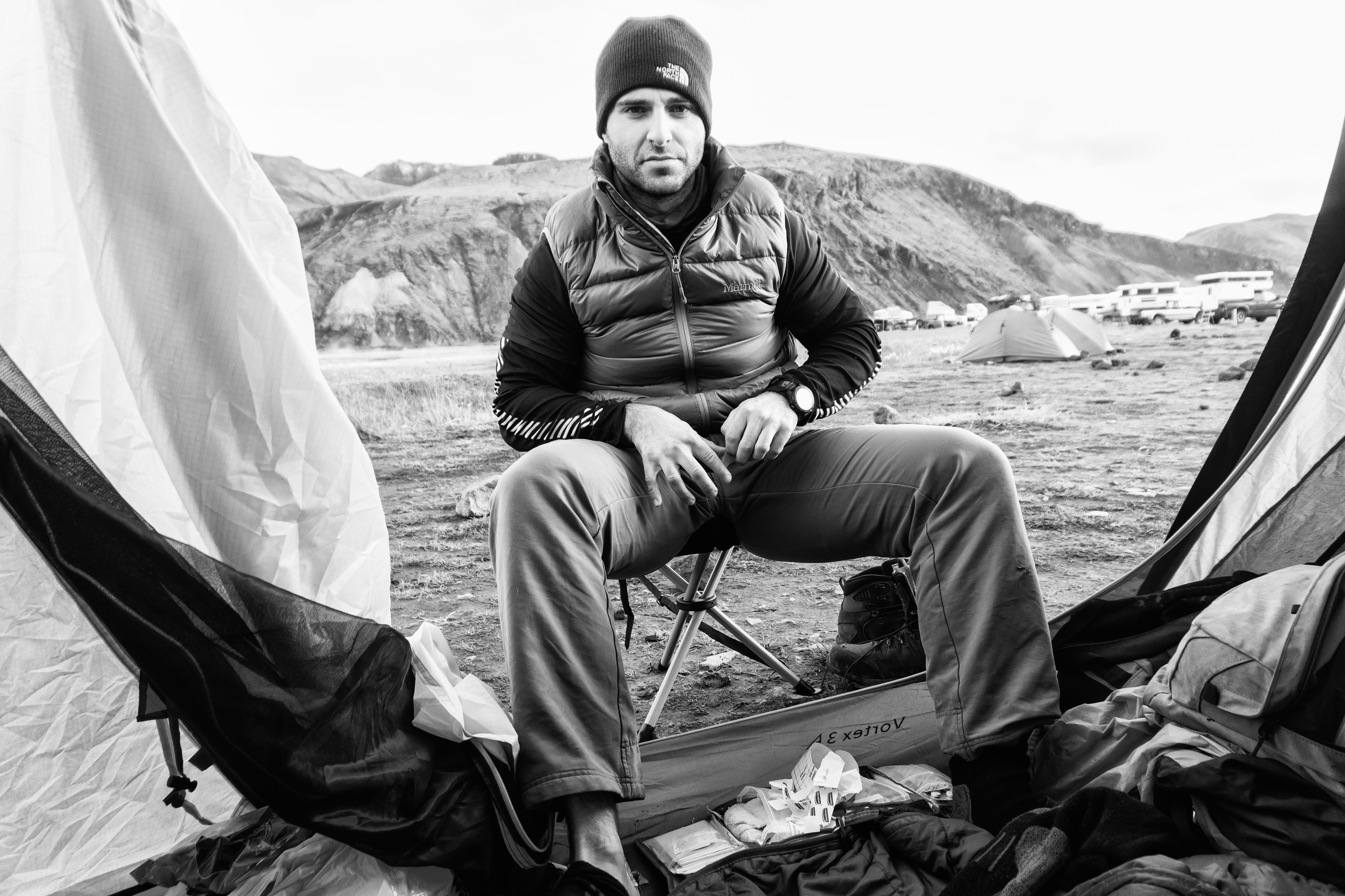
 *Early morning preparations with Cristian before breaking camp and leaving Landmannalaugar for the walk*
The advantages of trekking in a group are many – one of them is the ability to divide up the weight load, Linh and I carried around 16kg of food while Cristian carried the the large Denali Vortex 3-men tent. The tent itself can accommodate more than just 3 grown men but also had sufficient room for our 3 packs as well as room to move and miscellaneous items. I cannot stress the importance of a good, expensive tent. The Denali was fast to set up – less than 5 mins between 2 people – and very sturdy in the windy conditions of the Icelandic highlands; never cheap out on a tent when you are trekking, especially in unpredictable environments.
PERSONAL CLOTHING SET UP:
During the actual trek I wore –
- Columbia Dri-Fit shirt
- Helly Hansen lightweight fleece jacket (only at higher altitude)
- Marmot Precip waterproof/windproof jacket
- North Face convertible pants
- Salomon 3D Comet boots
- Sea To Summit knee high gaiters
I also carried waterproof pants in the backpack, in case of heavy rain. Fortunately we did not encounter any adverse weather conditions, save for light snow near the glaciers at around 1000m in altitude. At nights I wore lightweight thermal long sleeve top and bottoms at around 160gsm thickness, with a lightweight sleeping bag rated to only 0 degrees. I had a warm and comfortable sleep on top of the Sea To Summit Ultra Light Insulated inflatable sleeping mat, with an R-value of 3.3, which is a good level of warmth even in sub-zero temperature.
From the main BSI bus terminal in Reykjavik (which is operated by Reykjavik Excursions) I decided for the group to head for the trail-head and main campsite at Landmannalaugar a night early.This was so we could depart for the trek in the morning.–. It was a 4-hour bus journey and encompassing a variety of stops by the tour guide to show us the diverse nature of the Icelandic countryside, with tales of their mythical mountain trolls of yore and history of this beautifully rugged land.
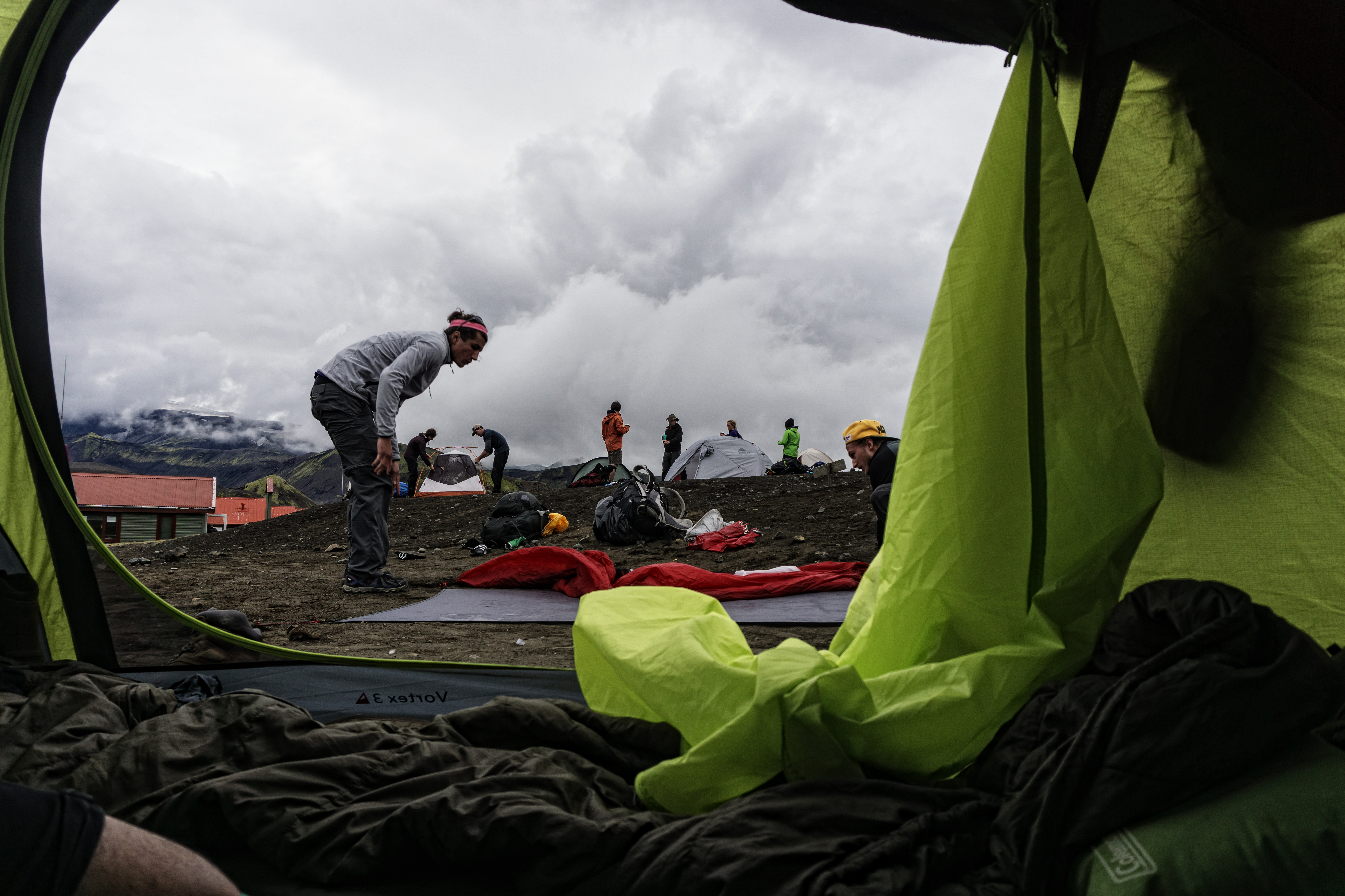
It was after 9PM when we arrived at Landmannalaugar – and it was tent city. Some were overnight trekkers who came to explore the surrounding colourful hills and mountains and to enjoy the amazing natural hot springs, while most were starting out or at the end point of the Laugavegur trek. Being so close to the North Pole meant that we had sunlight till nearly 11PM and had sufficient light to erect the tent and settled in for the night. The main drawcard of the Landmannalaugar campsite is the large natural hot spring bubbling right next to the tents. We joined the throngs of trekkers stripping down to our bathers in the dark outdoors in single digit temperature – and plunging into steaming hot water heated by volcanic vents. Stray too close to the steam and you could feel the painful rush of scolding water occasionally flashing past you on top of the already hot water. It was an incredible experience to lie there in the mountains in the dark and soothed by the healing power of nature.
The next morning was a hustle and bustle of tents being collapsed, meals being cooked, a surprisingly modern unisex bathroom and showers building bursting with trekkers in their morning routines before departing. Just like that, we set off after 8AM, with early risers already seen walking in the distant hills.
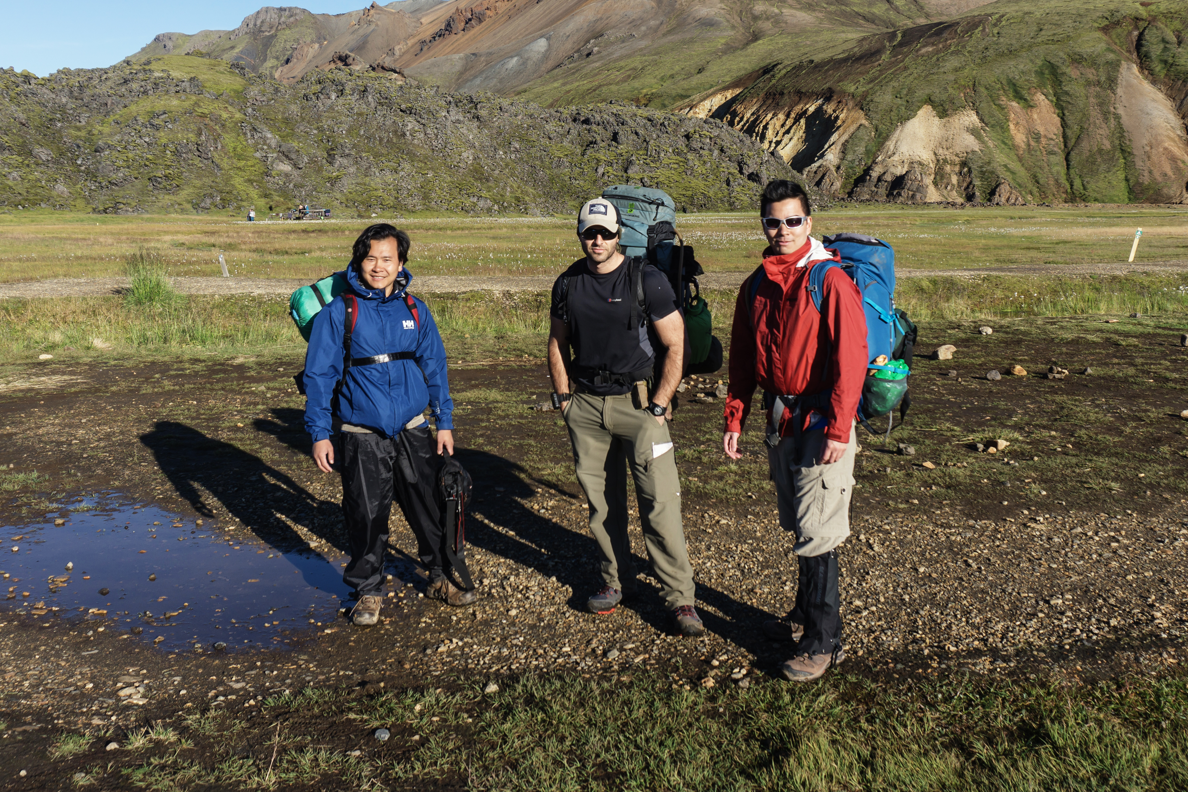
 *Last photo before the start of the trek, with the trail head behind us*
DAY 1 – Landmannalaugar to Alftavatn
We knew this day would be a tough one, as we planned to reach all the way to Alftavatn before nightfall – involving a 25KM leg with a lot of hills to ascend and descend ahead.
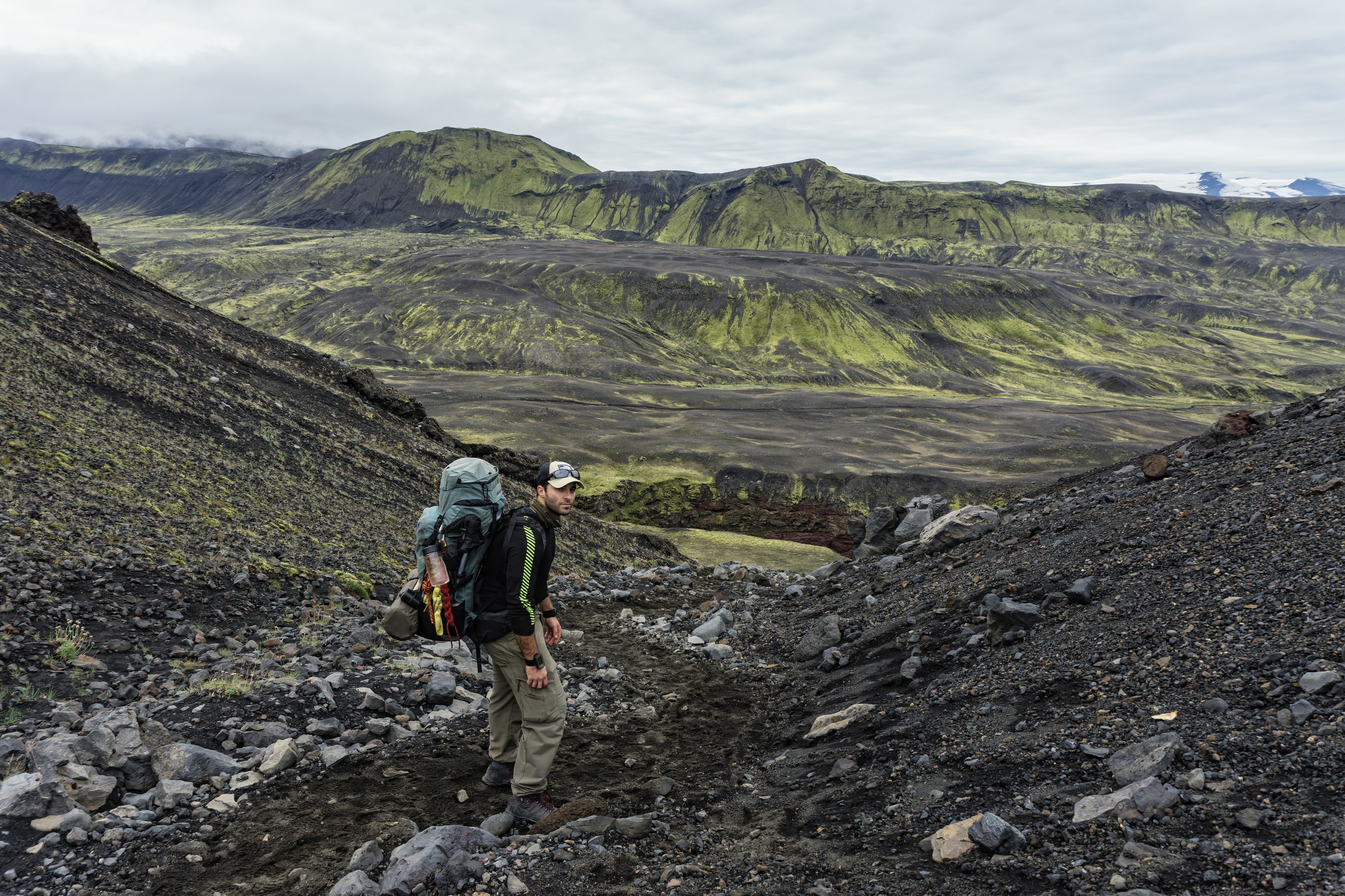
I won’t lie, it was a hard day; I consider myself to be of a good fitness and strength level, but a 25KM day up and down hills with a 20kg backpack is tiring for anyone. But the landscape –wow what a view that was throughout the whole day. Probably the best distraction from our muscle fatigue is evident every time we gaze around this ancient yet diverse landscape.
 *The struggles of hill ascents and descents begin, but what a beautiful struggle it turned out to be*
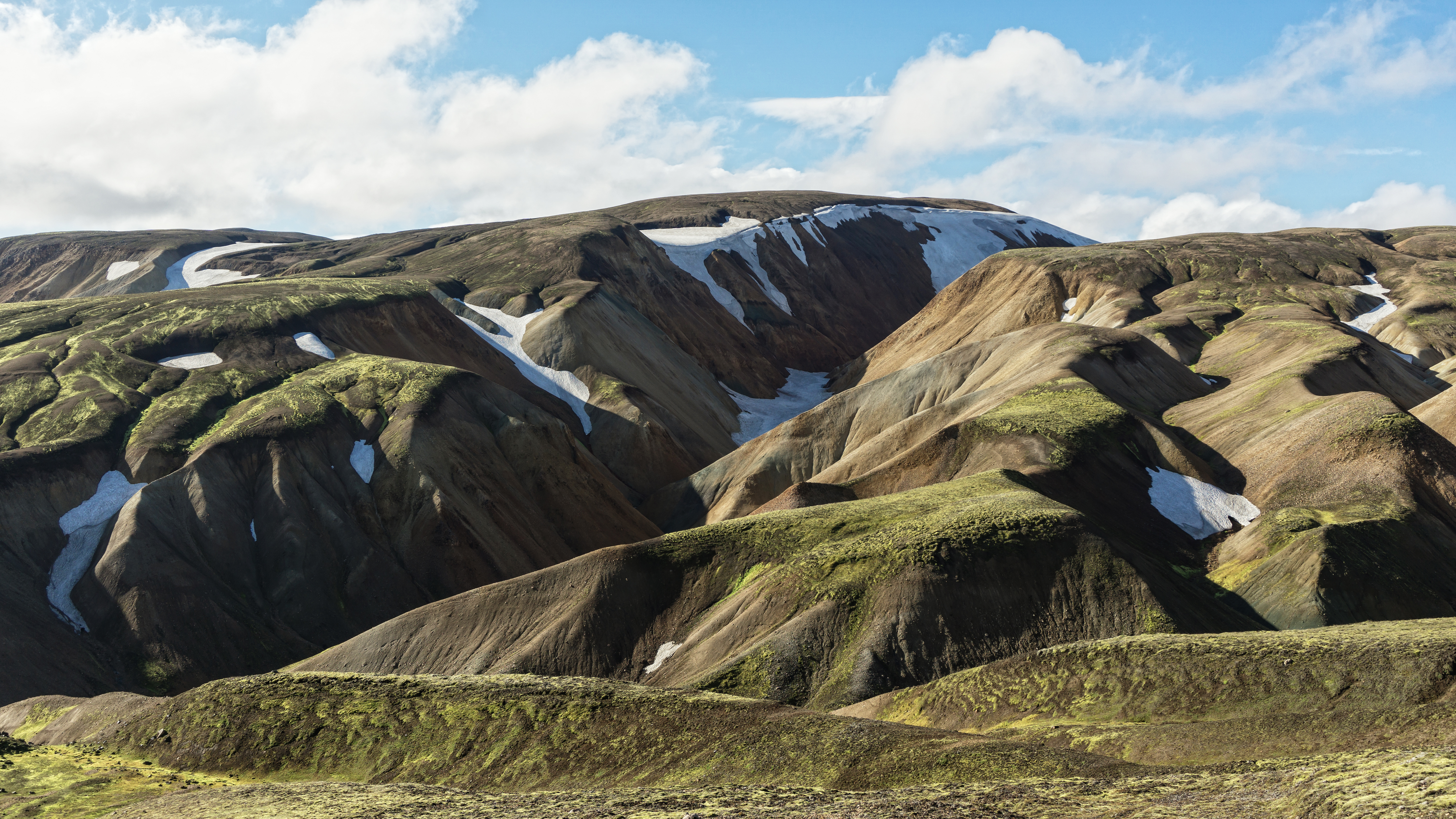
 *We occasionally paused, to simply admire the spectacle around us. This was a valley of moss and lava rocks not far from departing Landmmanlaugar and is popular with day walkers and casual visitors*
 *As we climbed higher, we start encountering patches of snow mixed with moss covered hills and occasional volcanic vents gushing out hot, steaming air and creating warm pockets along the trail*
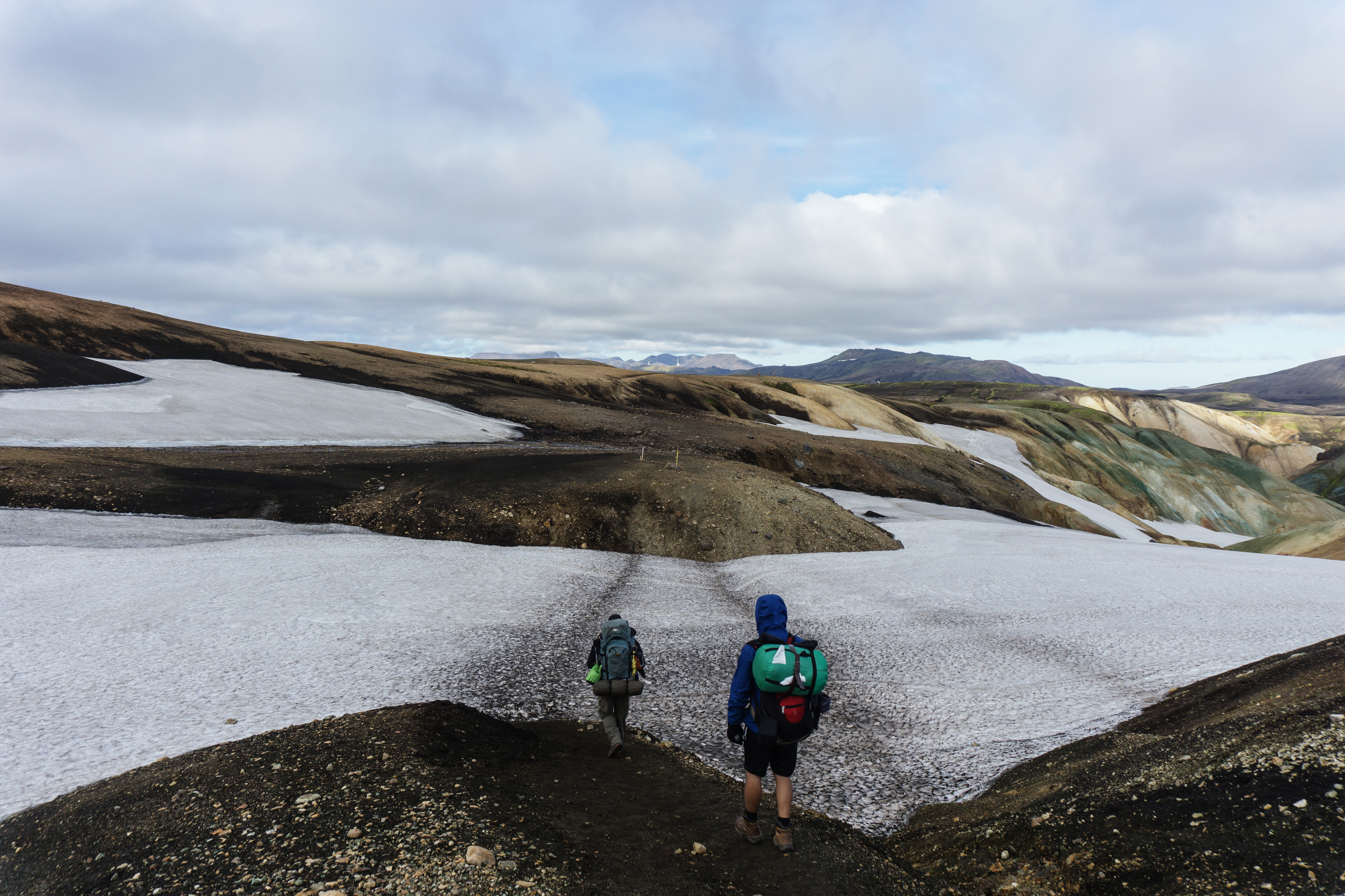
 *I had been looking forward to hitting the snowfields all morning, and it did not disappoint at all. The wind chill factor rose sharply and it was very cold. As we trudged on the visibility became lower and lower and we encountered light rain and snow at certain parts*
 *I took this at one of the more dangerous parts of the snowfields, as the trail became less visible to see and follow. Linh wore shorts here and we were fortunate to not have any sudden extreme changes in weather*
 *This is why the area is dangerous. A young Israeli trekker died during a blizzard in the snowfields*
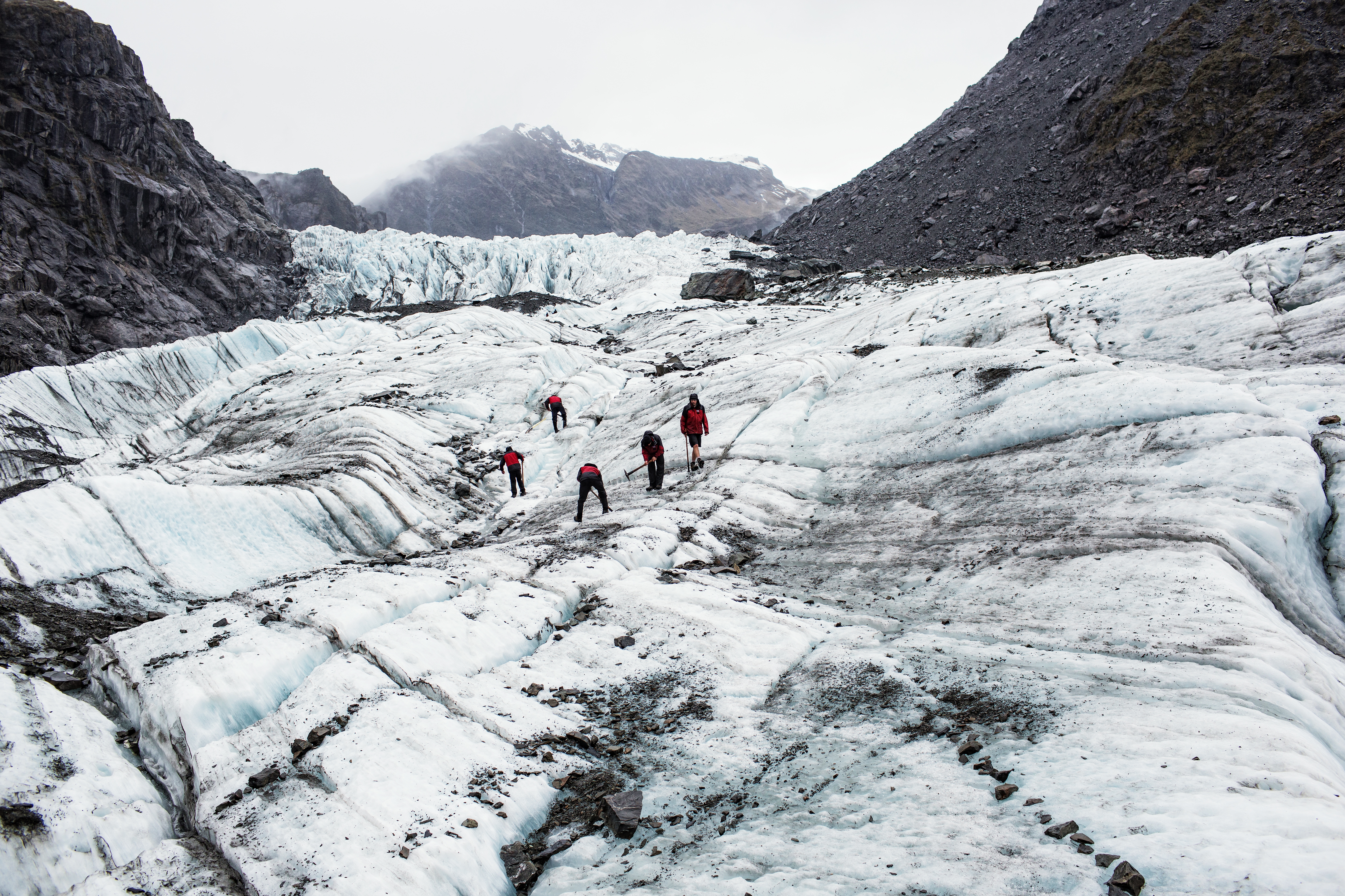
 *Beyond these snowy slopes are the glaciers, they can be reached and walked upon but only recommended to experienced and prepared mountaineers*
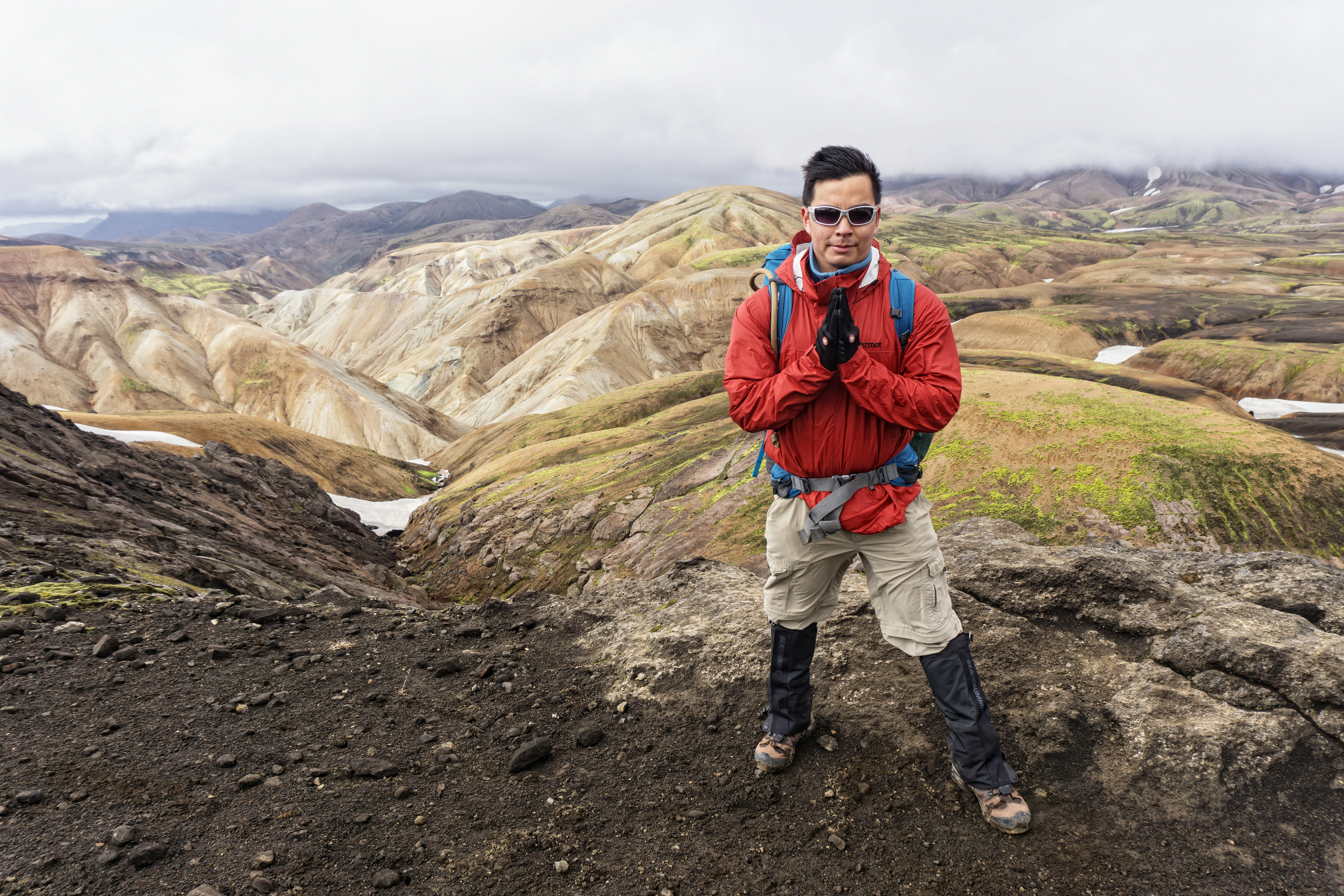
 *This photo of myself could not represent how strong the wind chill factor is at around 1000m altitude*
 *There are many volcanic vents steaming into streams on the first day of the trek. These places make for a good emergency stop, as its significantly warmer and provides a source of fresh water too*
 *One of the best and most helpful features of the Laugavegur trail is that you do not need to carry much water at all. As there are many freshwater streams criss-crossing the whole trail and one is never far from any water source. It was one of the best freshwater I had ever tasted as well.
The most spectacular view and the hardest part of DAY 1 was the steep and long descent to Alftavatn Lake from the mountainside. It was an hour or so of steep, knee-jarring descent. For anyone with weak knees, it is advisable to carry walking poles to assist you on the way down to take the strain of the knees and reduce the danger of falling over.
 *I have seen a lot of incredible landscapes around the world over the years, but this had to be one of the most memorable of all. It reminded me of the cartoon ‘A Land Before Time’. We stopped here for a while to simply take in the natural beauty.
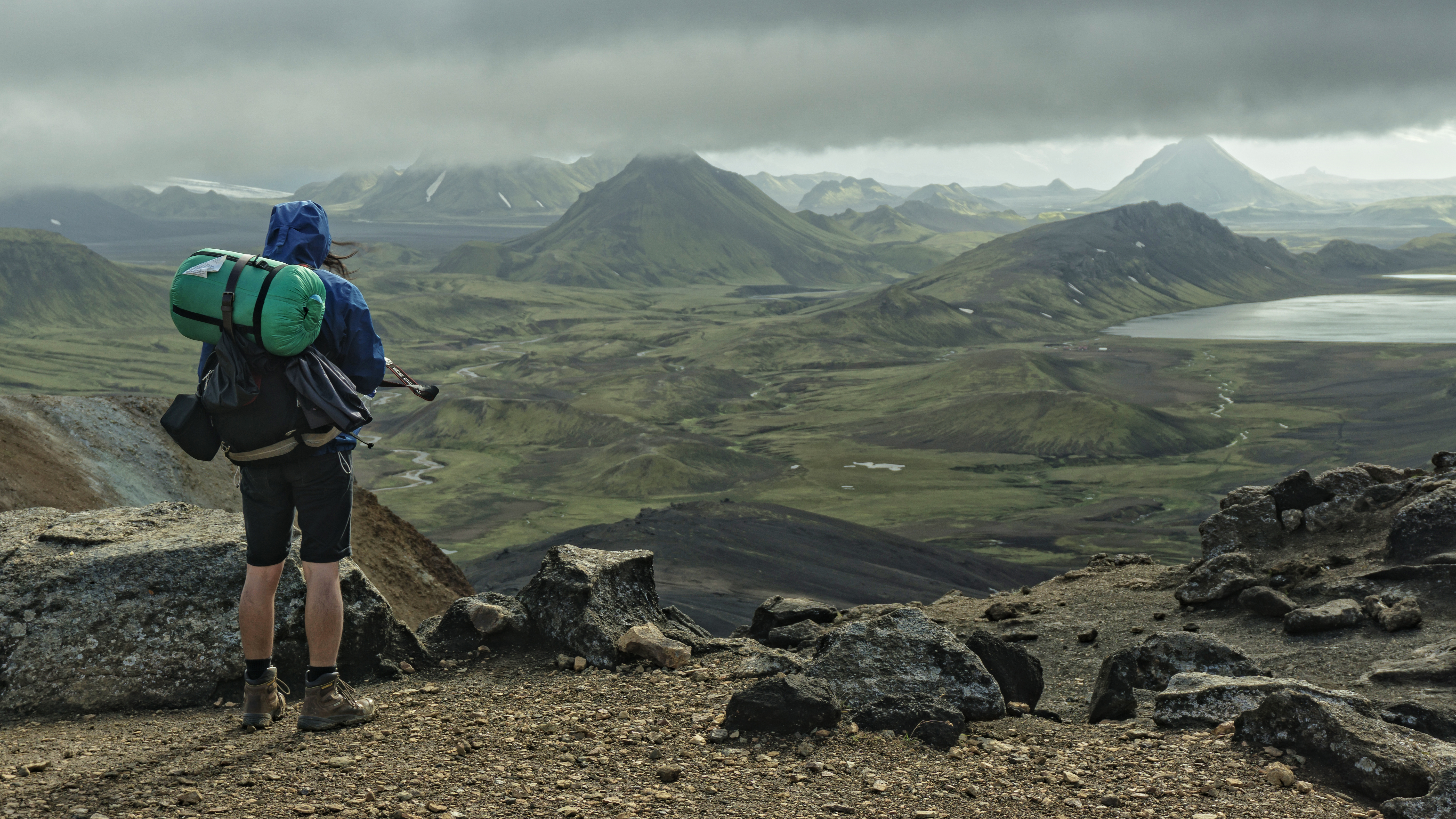
 *Alftavatn Lake to the left, with the campsite on its shores around 4KM away from where I took this photo. A small gap in the dark, low hanging clouds revealed a beautiful spot of sunshine on the winding river*
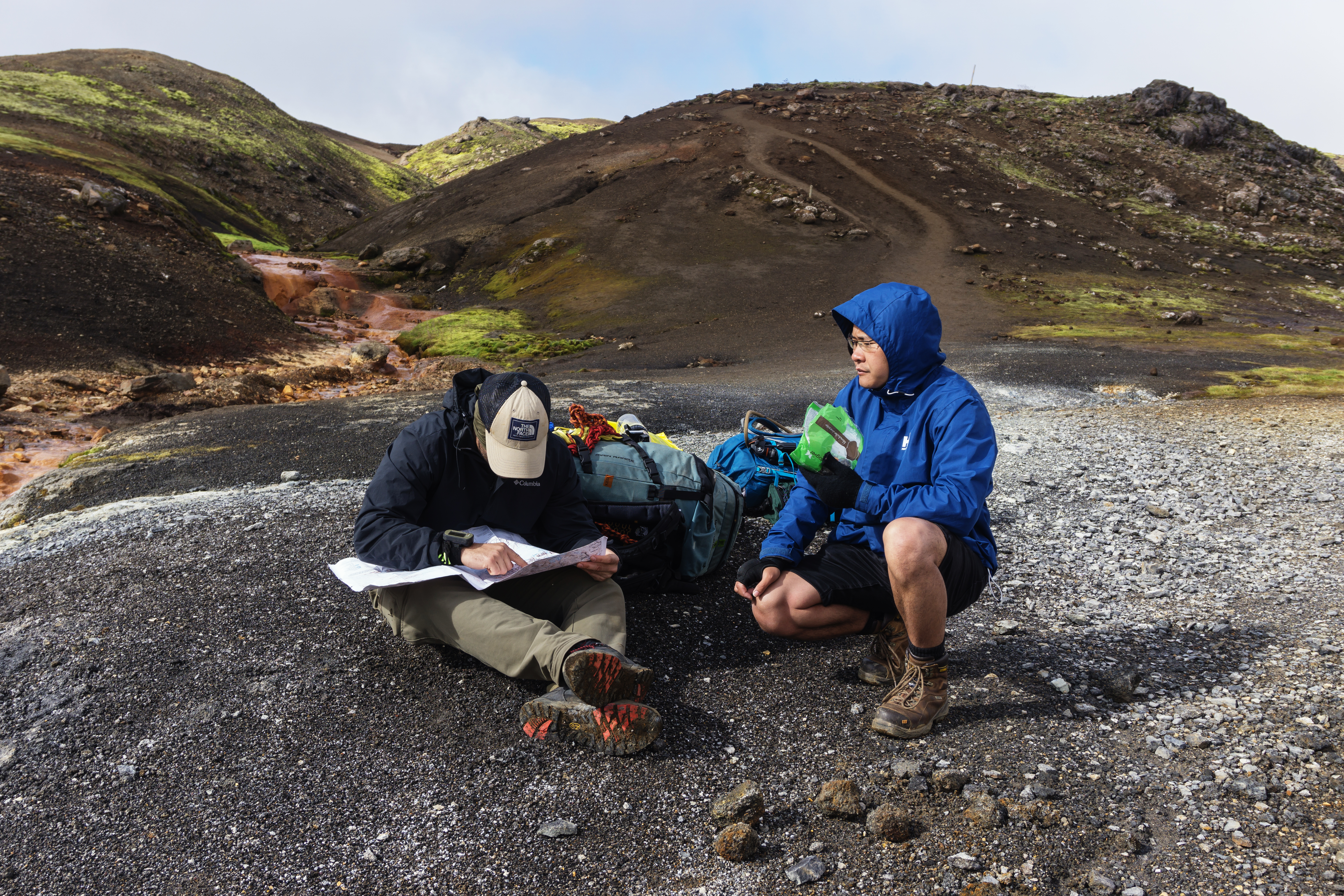
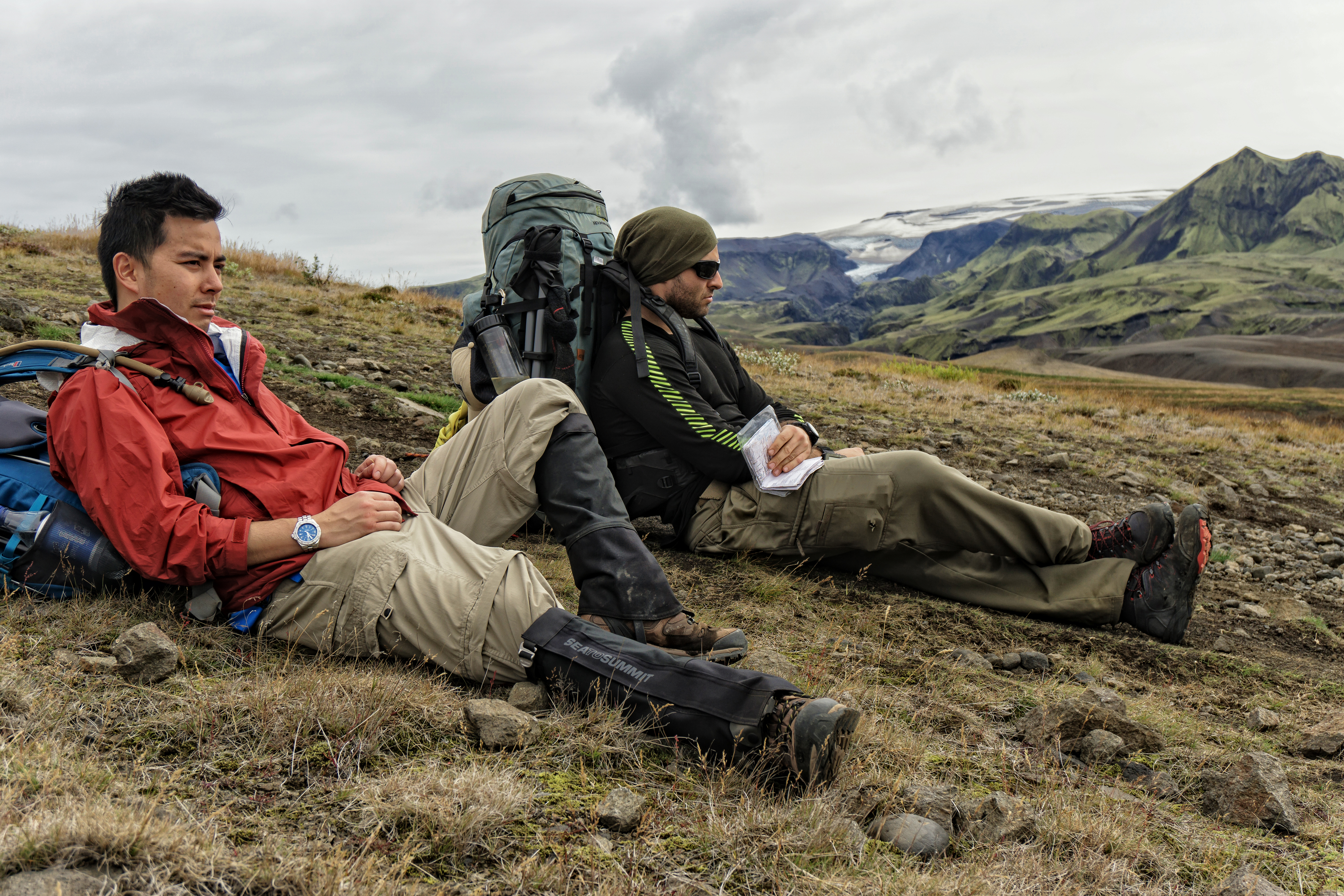
 *Some last minute map check, and a quick energizing stop*
PERSONAL ADVICE: One of the reasons we walked 25KM instead of the usual 12KM on the first day, was that we wanted to skip the main checkpoint and cabin at Hrafntinnusker – the halfway point between Landmannalaugar and Alftavatn. From reading trekking diaries of those that had accomplished the trek and my own research, I believe it was the correct and excellent choice to skip spending the night here. The main cabin and campsite lies at an elevation around 1000m in altitude, and was extremely foggy with a very high wind chill factor. Its close proximity to the snowfields and glacier made for a very cold lunch stop. I personally think this is not a great place to set up camp for the night and would recommend anyone to keep pushing the extra 12KM to Alftavatn Lake at an elevation of 565m and much calmer weather.
DAY 2 – Alftavatn to Botnar (Emstrur)
Today was a much easier day, albeit with some sore limbs and shoulders. The landscape had shifted dramatically with the majority of the 15KM leg of the second day spent walking through black sands and huge calderas of ancient volcanoes from prehistoric times. We regretted not staying in Alftavatn for another night as it was a very picturesque campsite by the lake and surrounded by moss covered hills and volcanic craters.
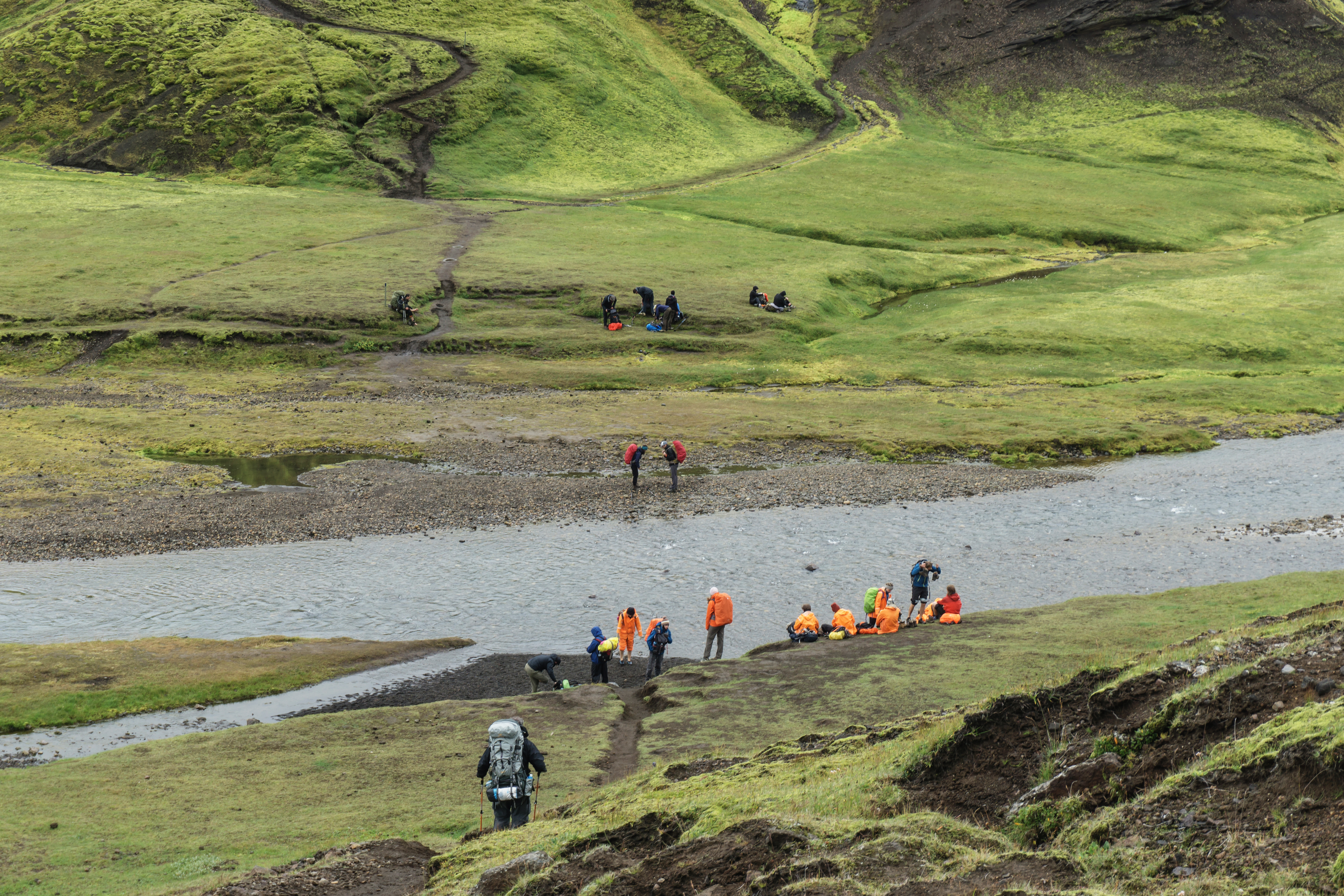
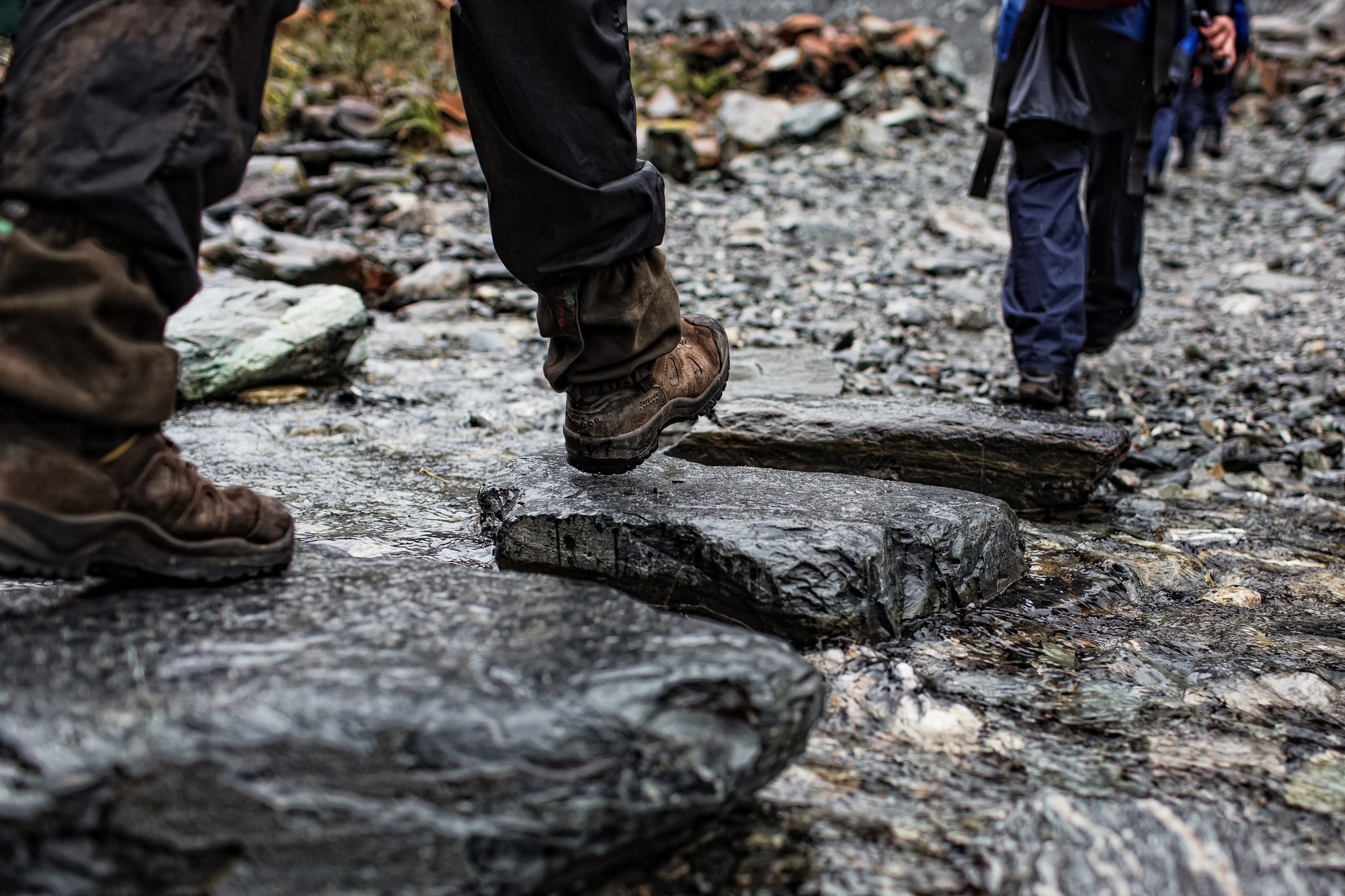
Near the end of the day we encountered the second river crossing and most significant one yet. With a strong current and knee-deep water level on that day, the melted glacial water was one of the most painful experiences I had encountered. I highly recommend using walking poles for support, or have a buddy system to hold onto each other for support whilst crossing.
 *It is highly recommended to bring along a pair of flip-flops, sandals or old shoes for these river crossings, the frigid water is piercingly painful and the riverbeds are very rocky*
 *There are 2 river crossings on the second day. With the second crossing, we experienced a much stronger current and a wider river. This is where walking poles or a buddy system to hold onto can stop you from falling into the water*
 *After the second and last river crossing of the day, we were more than happy to see flat terrain as far as the eyes could see, with some very desolate but scenic views of ancient hills and volcanoes surrounding us*
 *From here on, it was simply following a rough 4WD road most of the way to Botnar campsite for the next few hours*
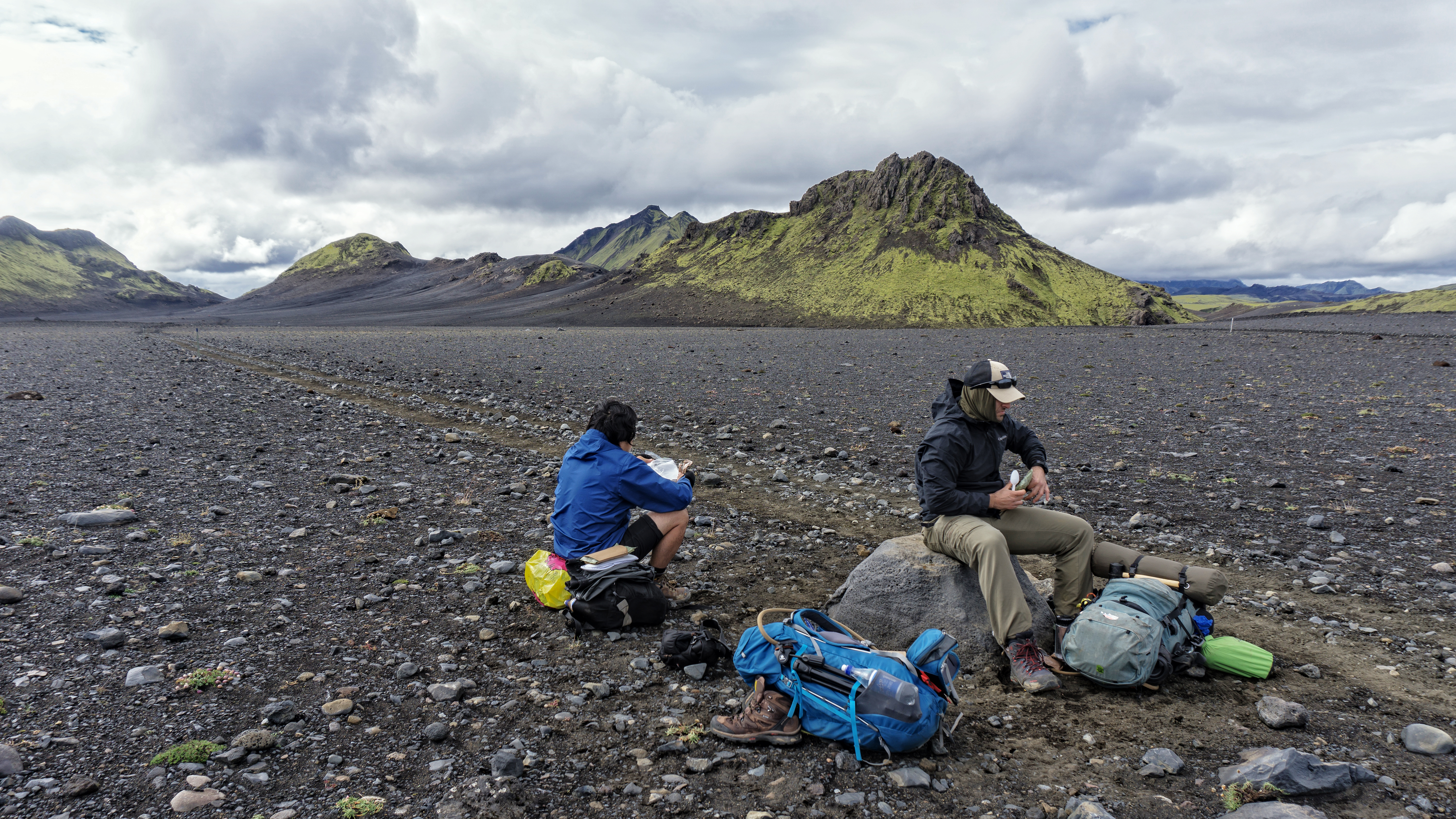
 *Lunch stop, and more MREs to consume. The self heating meal packets were excellent in allowing us to have more free time and not set up any gas cookers*
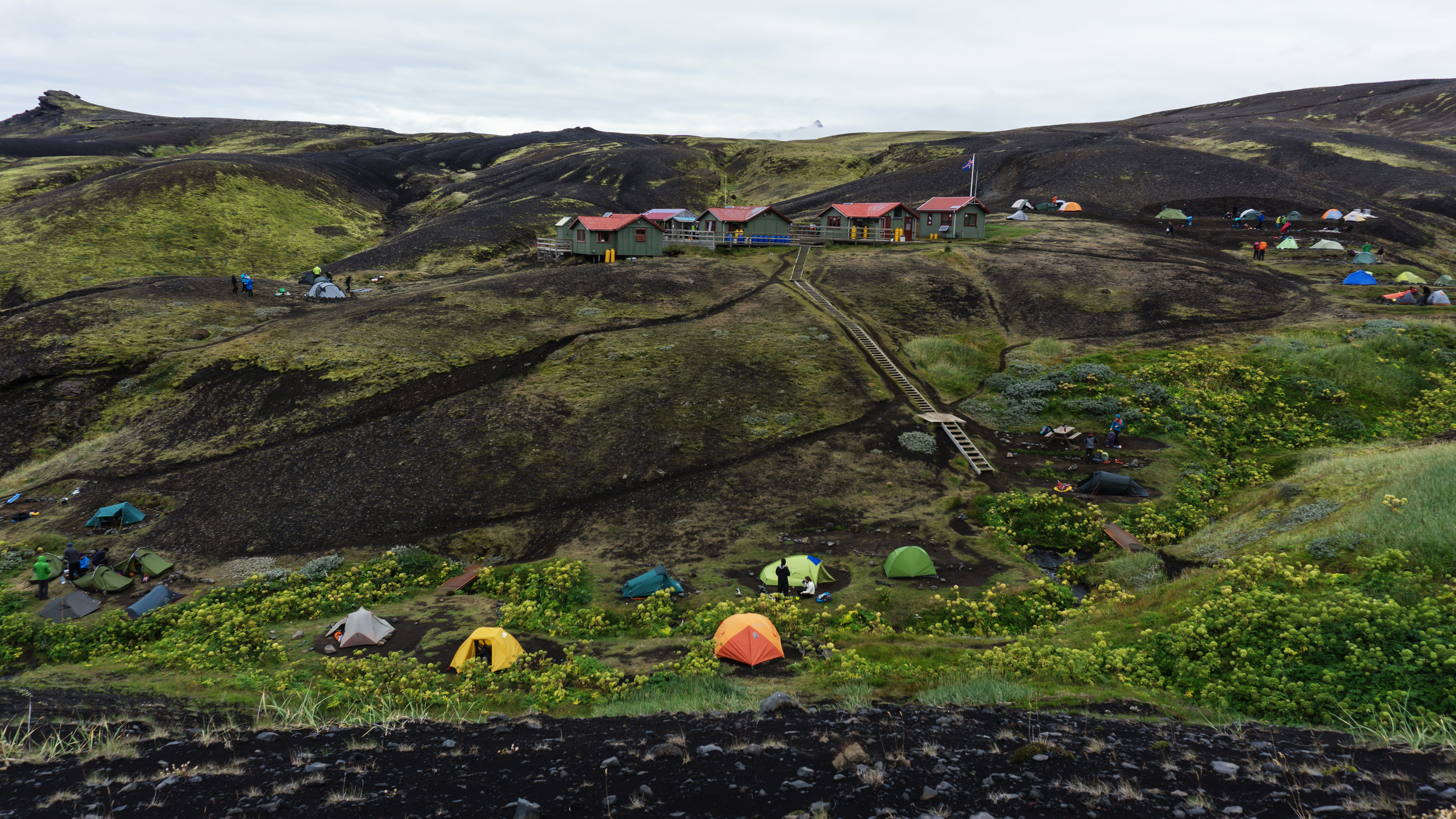
 *Resting on a slope with Botnar campsite below us. We made excellent time on the second day and had arrived at the site before many other trekking groups and individuals, thus allowing us to find a more ideal area to pitch the tent*
 *An afternoon nap later, we awoke to find other trekkers who had just arrived, hurriedly setting up tents as low clouds appeared with flickers of rain. But luckily the weather once again held out*
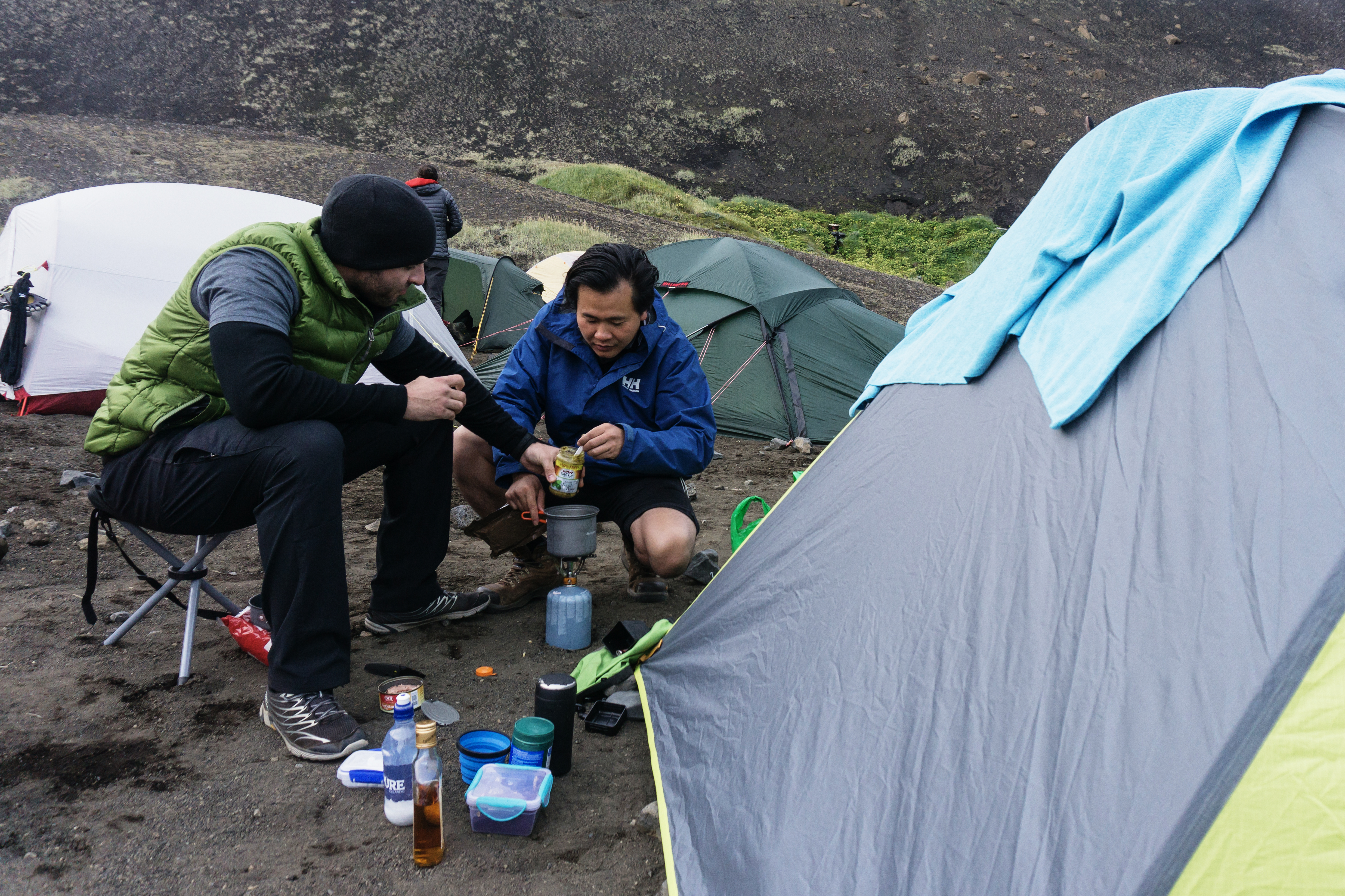
 *Cooking the ubiquitous pasta meal, a classic meal for trekkers around the world – as it allows for a high amount of energy and carbohydrates, very easy to carry and cook, and can be mixed with a variety of condiments*
DAY 3 – Botnar (Emstrur) to Thorsmork
The last day of the trek, our main focus was to reach Thorsmork campsite to catch the large 4WD bus back to Reyjavik at 1530.Another day, another shift in landscape and weather – right after leaving the campsite, we encountered a steep descent down a hillside covered in loose volcanic ash, proceeded by a beautiful crossing of a deep gorge with fixed rope to aid the descent.
 *A view of Botnar campsite as we departed early in the morning, with many groups traversing the opposite direction or simply sleeping in for a while longer. But we had a bus to catch that afternoon*
 *The descent from Botnar to the river and gorge was quite slippery and steep on the volcanic sands. I would hate to be doing the opposite traverse and climbing this slope to the campsite after a day of walking*
 *A beautiful gorge crossing and a raging river below, a few kilometres out of Botnar*
 *Cristian on a ledge, looking down onto the gorge and river. This are is a great place for landscape photos *
One could really feel the temperature warming up, as we are descending lower and lower to our final campsite. I knew that we would eventually encounter our final river crossing, but I did not anticipate how wide the Pronga River was – which eventuated into 5 smaller crossings to get to the other side of the bank.
It was a surreal experience; the last few kilometres of the trek were through lush green forests before seeing the huts at Thorsmork, ringed by tall hills and glaciers in the distance. We made it, in roughly 2.5 days of trekking, even though the recommended duration is around 4 days for many people.
 *A short rest on the hill, before crossing the wide Pronga river below us. In the distance is a column of smoke rising from an active volcano near a glacier. It truly is the land of fire and ice*
Looking back, the three of us sincerely believed that was one of the most unique treks and landscapes we have witnessed and traversed. There was nothing else like what we saw on Earth – from prehistoric landscapes to witnessing the collision of fire and ice, to the stark and desolate beauty of ash-covered calderas. We would do it again, but for longer, to truly take in this unique place in the world.
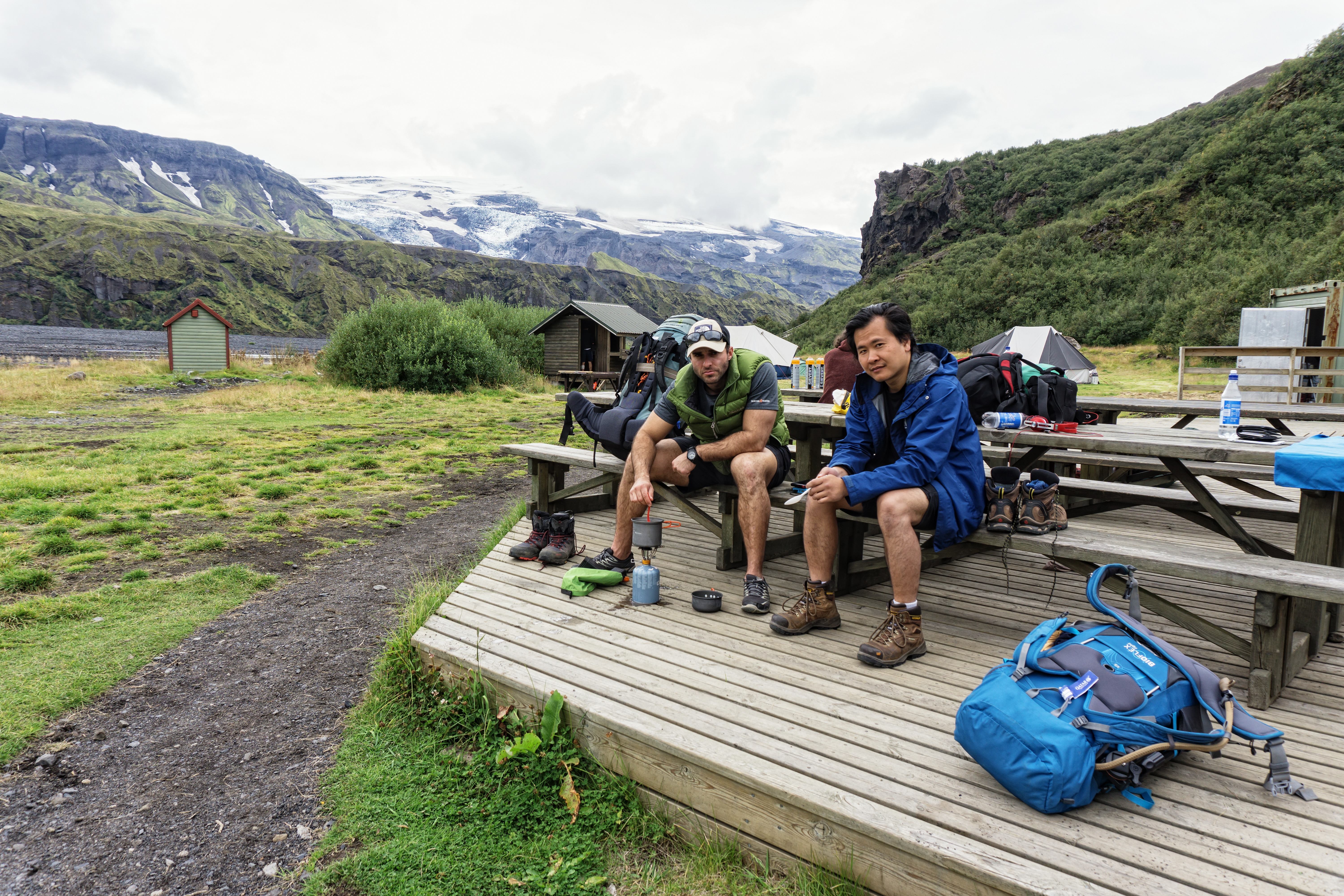
 *At the picturesque Thorsmork campsite, finishing off the last of our pasta and waiting for the bus to arrive*
MY REFLECTIONS – four months on
I had seen different friends on social media visiting Iceland in the last few months, their photos are beautiful, but they are all the same. Road trips and day trips around Iceland and the coastlines are stunning, but it does not offer the type of diversity as what we had witnessed on our trek. To us, and to the locals that have walked the trail – that is the real Iceland, a place of abrupt changes in diversity, of fire and ice and of desolate features that had to be seen and experienced with one’s eyes. You really have to visit the interior of Iceland to see the real country, the highlands is where its true beauty lies.
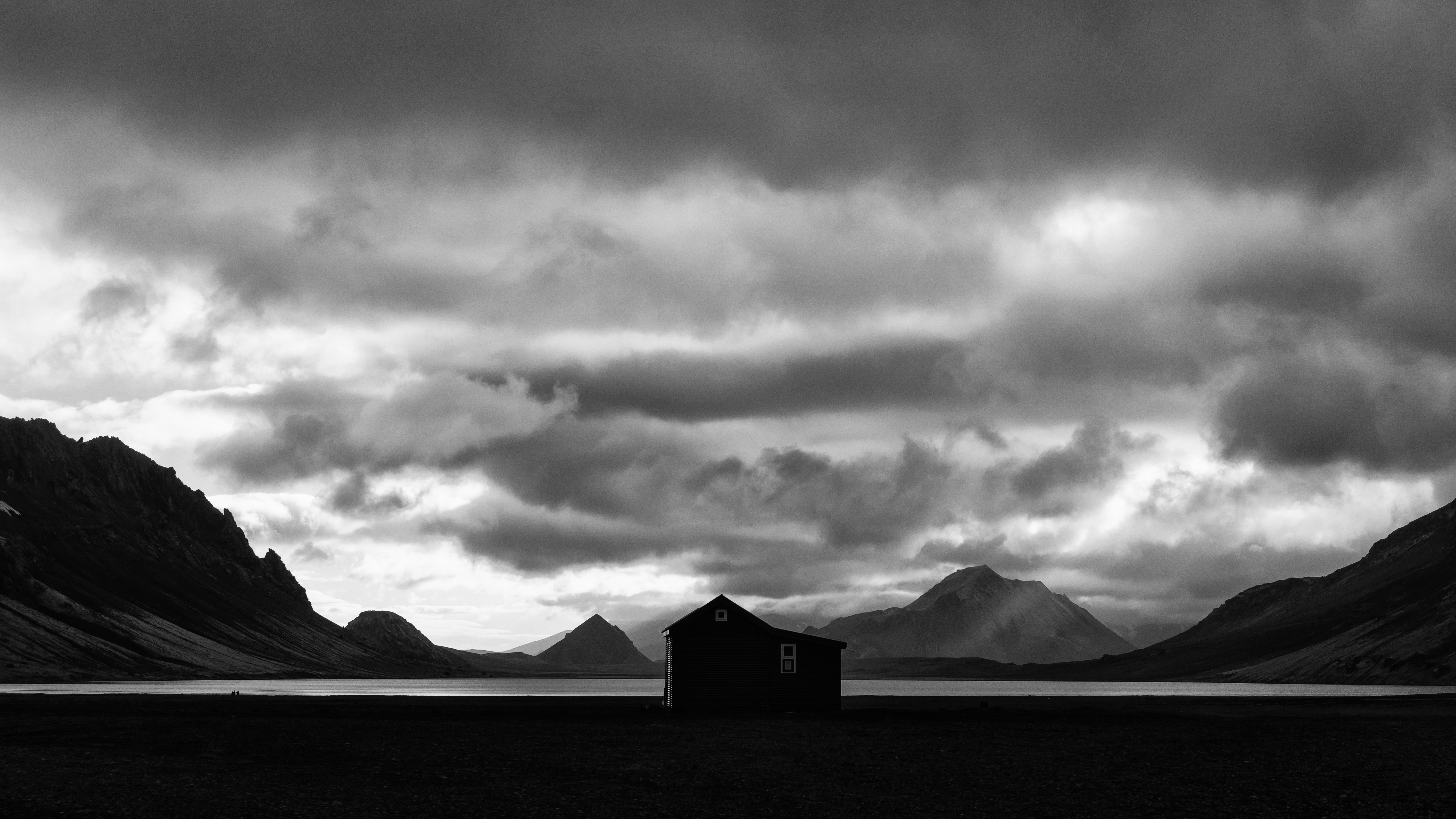
 *One of my favourite landscape photos from the trek, a hut by Alftavatn Lake at dusk*
Follow me on Instagram at @jackietranphotography.
or my Facebook work page – Jackie TRAN.